
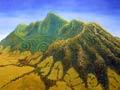


The Waikato region lies in the upper North Island, rimmed by ranges and bordered on its wild west coast by the Tasman Sea. Waikato is a much-altered landscape. Its swamps have been drained and vegetation cleared to create pasture and, in south Waikato, exotic forests. Unchanged are the sentinel mountains – Taupiri, Karioi, Pirongia, Kakepuku, Maungatautari, Maungakawa, Te Tāpui and Te Aroha. Another constant is the majestic Waikato River – ‘the river of life’,1 as it has been called in a famous waiata. The Waikato, Waipā, Piako and Waihou rivers and their tributaries flow through some of the most productive land in New Zealand.
Boundaries
The Waikato region encompasses the Waikato, Matamata–Piako, Waipā and South Waikato districts, and Hamilton city. This is smaller than the Waikato regional council area, which extends to the King Country, Taupō, Hauraki and the Coromandel Peninsula, and parts of Rotorua district.
The fourth main centre
Although it has been cold-shouldered as a brash newcomer by the traditional four main centres (Auckland, Wellington, Christchurch and Dunedin), Hamilton’s population far surpasses that of Dunedin.
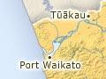
The region covers around 9,325 sq km – 3.5% of New Zealand’s land mass. In 2013 it had 305,265 people – 7% of the national population. The main towns are Tokoroa, Cambridge and Te Awamutu, followed by Huntly, Morrinsville and Matamata, and then Putaruru, Te Aroha, Tūākau and Raglan. All are dwarfed by Hamilton, New Zealand’s largest inland city, which, with a population of 141,612, was home to nearly half the region’s inhabitants in 2013.
A turbulent history
Waikato was the stage on which some of the most significant dramas in New Zealand history were enacted. Settled in the 13th century by Māori from the Tainui waka (canoe), the region was densely populated in the early 19th century. From that time Māori began to adopt European practices – some beneficial, others not. Farming enabled Waikato tribes to grow produce for local and overseas markets. Musket warfare, however, contributed to instability and migrations within and beyond the region.
A desire to protect their lands, culture and mana prompted some tribes to elect a king in 1858. They chose a Waikato chief, Pōtatau Te Wherowhero, and since then the Kīngitanga (King movement) has been based in Waikato. The movement was immediately seen by the government as a threat. In 1863 troops invaded Waikato to punish the King’s followers and confiscate their fertile lands. By mid-1864 western and central Waikato was in Pākehā hands and many of its Māori inhabitants were in exile in lands to the south, which became known as the King Country.
Pākehā settlement
Although explorers, traders and missionaries came before, the first permanent Pākehā settlers were soldiers guarding militia townships. The land they were granted turned out to be less ideal for agriculture than first thought. It took extensive swamp drainage schemes, scientific advances in soil and pasture management and herd improvement, and many years of back-breaking labour, before Waikato became New Zealand’s foremost dairying area.
The realisation that exotic forestry was an ideal use for south Waikato pumice lands did not dawn until the 1920s. Along with farming and forestry, major industries such as coal mining and hydroelectricity production developed, turning Waikato into the country’s ‘economic engine room’2.
The return of Waikato-Tainui
Dispossessed Waikato Māori began returning to their ancestral lands in the late 19th century, and in the 1920s built an important marae at Ngāruawāhia, Tūrangawaewae. A long struggle for official recognition of the injustice of the invasion and land confiscations of the 1860s finally resulted in the Waikato Raupatu Claims Settlement Act 1995, which included an apology from the Crown and financial compensation. In the 21st century, Waikato-Tainui tribes are a major economic force in the region.