
Before European settlement, the flat plains all over Southland were covered by bush – mataī, rimu, lowland beech, kānuka and mānuka, interspersed with tussock grasslands, and swamp and bog in low-lying areas.
The bush settlements
Early settlers named their districts after the bush they cleared. These places still have much in common – small rural settlements usually close to bigger provincial towns, built to serve local farms.
There are at least 18 ‘bushes’. Some remain settlements; others survive only as the name of a district.
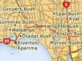
- Bush Siding is a community near Gorge Road, east of Invercargill.
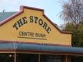
- Centre Bush, 13 km north of Winton, was first settled in 1865. It retains two churches, craft shops, a school and a rugby club.
- Croydon Bush, 13 km west of Gore, is named for a tract of bush and the neighbouring district of some 50 sheep and dairy farms, and lifestyle blocks.
- Eastern Bush covers farmland in the Wairio River valley, 15 km north of Tūātapere.
- Gropers Bush is equidistant from Ōtautau and Riverton/Aparima. It was said to have been named Hāpuka (groper, a coastal fish) by Māori, because the bush was shaped like the fish. Today, only a tiny library remains.
- Grove Bush, 20 km north-east of Invercargill, has farms with sheep, cattle and deer.
- Gummies Bush, just north of Riverton/Aparima, was named after whaler and later pig-farmer James Leader, nicknamed ‘Gummie’ because he had no teeth.
- Heddon Bush serves a rich cropping and sheep-farming district 20 km north-west of Winton.
- Longbush, on State Highway 1 near Woodlands, was named after a long stretch of native bush. It now has only a dairy, on the main road.
- Mabel Bush is close to Grove Bush and serves local farms. It had sawmills and flax mills until the 1930s.
- Myross Bush, 11 km north-east of Invercargill, is a rich farming district which once had a school, hall, post office and church. The school and hall remain, but most land is lightly farmed by city workers on 4-hectare blocks.
- Ōtaitai Bush grew as a farming area because it was near the port of Riverton/Aparima. Today, it is home to thoroughbred horse trainers.
- Roslyn Bush forms a triangle of close farming settlements with Longbush and Myross Bush.
- Ryal Bush sits between Invercargill and Winton, close to State Highway 6. Sheep, cropping and dairying predominate, and the old schoolhouse serves as a community centre.
- Seaward Bush skirts the south-east boundary of Invercargill and is now home to a native bush reserve.
- Spar Bush sits 12 km north-west of Ryal Bush.
- Wreys Bush community covers an area a few kilometres south-west of Nightcaps, straddling the upper Aparima River.
- Wrights Bush is a productive sheep- and dairy-farming area between Invercargill and Riverton/Aparima. A transport company is still based there and the community gathers in the hall.
- Waipango, about 10 km north-west of Riverton/Aparima, was originally known as Wild Bush.
Hokonui Hills
The Hokonui Hills lie between the main Southland plain and the Waimea Plains, rising to between 600 and 700 metres. They were one of Southland’s main forested districts at the time of European settlement, but are now largely in pasture.
Hokonui moonshine
The hills became well-known as a site for illicit distilling. After the arrival of the Highland Scottish McRae clan (skilled distillers from Kintail in western Scotland) in the 1870s, the production of ‘Hokonui moonshine’ spread throughout the province. The whisky, 94% proof at its most potent, was popular with many sections of the community. But it was the scourge of temperance campaigners, police and excise officials between 1903 and 1954, when Gore was ‘dry’. After that, the ‘industry’ waned.
February 2007 saw the inaugural Moonshine Trail races at Gore’s Moonshine Festival – with a 40-km mountain bike race and 30- or 15-km runs across the Hokonui Hills. The US company Rayonier owns forests at the eastern end of the hills.