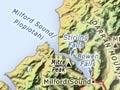

Milford Sound
Milford Sound/Piopiotahi is 120 km by road from Te Anau. Its surroundings are dominated by Mitre Peak, which rises 1,700 m out of the water. From valleys gouged by glaciers, impressive waterfalls (Bowen and Stirling) pour into the sea.
The sound’s Māori name, Piopiotahi, means a single thrush: the mythical hero Māui is said to have brought a thrush with him from Hawaiki. When Māui was crushed between the thighs of Hine-nui-te-pō (the goddess of death), the bird fled south, to give its name to the sound.
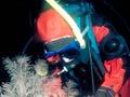
The combination of heavy rainfall (6,300 mm per year) and dense bush produces a permanent layer of fresh water on the surface of the sound, which reduces light levels in the water beneath. Many species live here that would normally only be found in deep water, beyond diving range – a phenomenon called ‘deep water emergence’. As in other fiords, divers can explore black coral trees, and lustrous red corals beneath them.
Tourists
By 1914, Milford Sound had become one of the country’s top resorts, despite the fact that most visitors had to walk in (some came by sea). Numbers increased exponentially after the Homer Tunnel opened in 1953, providing road access. Scenic flights to Milford were pioneered by Queenstown-based Fred ‘Popeye’ Lucas in the 1950s.
In the early 2000s, over 450,000 visited annually despite the massive rainfall, sandflies, and winter avalanche danger near the Homer Tunnel.
Milford Track
Often called ‘the finest walk in the world’, the 53.5-km (33-mile) Milford Track has attracted international trampers for more than 100 years.
Scottish immigrant and surveyor Quintin McKinnon discovered the pass that now bears his name (spelt as Mackinnon) in 1888. He accepted a contract to form a track, and to guide visitors and carry mail along it, and made a series of notable journeys of exploration in the area.
Walking the track
The four-day and three-night tramp begins with a launch trip up Te Anau and a short walk to Glade House or Clinton Hut. The next day there is a 16-km walk beside the Clinton River, through native beech forest to Pompolona Lodge or Mintaro Hut.
The next day, a 15-km walk to Quintin Lodge or Dumpling Hut involves a climb over Mackinnon Pass, with views back down Clinton Canyon, and north into Arthur Valley, with mountains on all sides.
From Quintin Lodge trampers can make a side trip west to the Sutherland Falls – named after Donald Sutherland, who discovered them in 1880. At 580 m they are not only New Zealand’s tallest falls, but one of the highest in the world.
A long way to fall
At 580 metres, Sutherland Falls are among the highest in the world. The highest are the Angel Falls in Venezuela, at 979 metres. Many of the world’s other high falls are in another glaciated country – Norway.
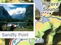
The last day’s walk (21 km) winds down the Arthur Valley, skirting Lake Brown and Lake Ada. It then follows the Arthur River to Sandfly Point, where trampers are collected to travel the last 3 km to Milford Sound by launch.
Hollyford River and valley
The Hollyford River rises near the Homer Tunnel and follows a northward course. In its lower reaches the river broadens out into the 15-km-long Lake McKerrow/Whakatipu Waitai, which gives way to a lagoon before the ocean is reached.
Runholders took up land in the valley in the 1860s. In 1870 the Otago provincial government laid out Jamestown on the east side of the lake and brought in settlers, but the settlement didn’t thrive.
The valley was added to Fiordland National Park in the 1960s. Walking tracks through beech forest follow the river to the sea at Martins Bay. A side track follows the Pyke River upstream past photogenic Lake Alabaster/Wāwāhi Waka and Lake Wilmot, crossing a low watershed and the Waiuna Lagoon to reach Big Bay.