
Story: Volcanoes

Monitoring earthquakes

Image
Monitoring earthquakes

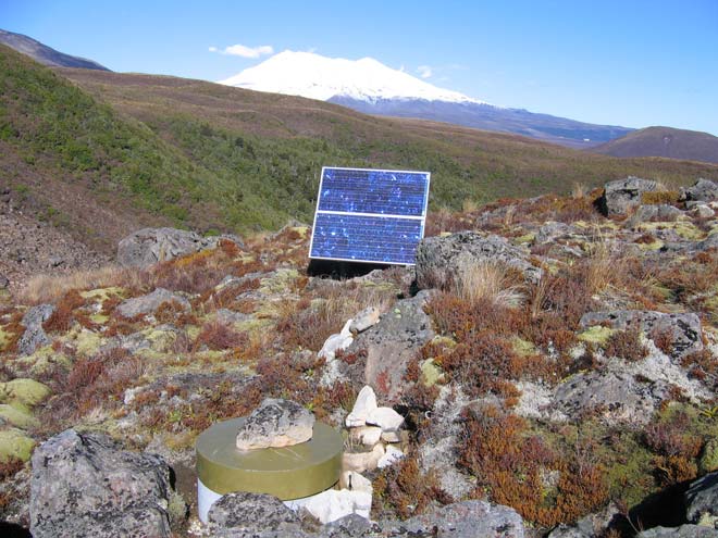
Increasing earthquake activity is one of the signs of magma (molten rock within the earth) moving up to the surface. There is a network of seismographs, which measure earthquake activity, at sites where volcanic eruptions are likely. A protective box surrounds this seismograph (foreground) in a remote part of Tongariro National Park, with Ruapehu in the background. The results are telemetered to GeoNet headquarters, where any changes in activity are monitored. Power is provided by a solar panel (centre).

Using this item

GNS Science

Permission of GNS Science must be obtained before any use of this image.

All images & media in this story

How to cite this page

Richard Smith, David J. Lowe and Ian Wright, Volcanoes – Monitoring active volcanoes, Te Ara – the Encyclopedia of New Zealand, https://teara.govt.nz/en/photograph/8740/monitoring-earthquakes (accessed 4 June 2026).

Story by Richard Smith, David J. Lowe and Ian Wright, published 2 March 2009.