Image
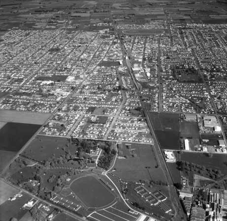
Hastings was laid out in a grid pattern intersected by a major railway line, which runs through the city centre. The pastoral and horticultural industries, which are a key part of the city’s economy and identity, are represented by the Hawke’s Bay Agricultural and Pastoral Society showgrounds and the Wattie’s factory. The Hawke’s Bay Racing Centre is visible at the top of the photograph.
Using this item
Alexander Turnbull Library, Whites Aviation Collection
Reference: WA-62411
by Leo Lemuel White
Permission of the Alexander Turnbull Library, National Library of New Zealand, Te Puna Mātauranga o Aotearoa, must be obtained before any re-use of this image.
Comments
04 August 2017
25 October 2016
14 October 2016