Image
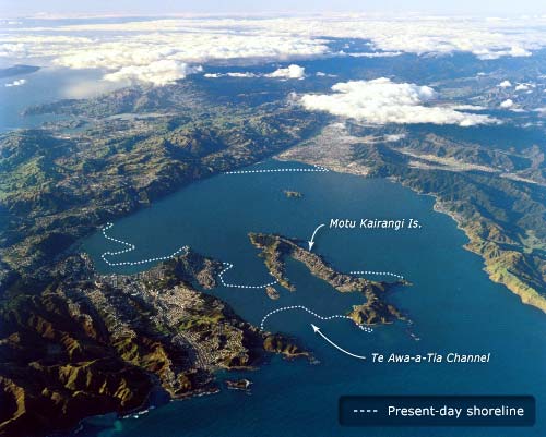
This view of Wellington has been modified to show the shoreline as it was before the Haowhenua earthquake, probably in the 15th century. At that time, Miramar Peninsula was the island of Motukairangi. The present-day coastline is marked by the dotted line.
Using this item
Reference: CN15244/24
by Lloyd Homer
Permission of GNS Science must be obtained before any use of this image.