Image
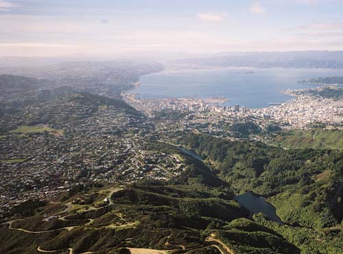
Wellington is crossed by three main faults: Pukerua, Ōhariu, and Wellington. This early 1990s view shows the Wellington Fault. It runs through the Zealandia (Karori Sanctuary) valley – containing two reservoirs – and the suburbs of Kelburn and Thorndon. It then forms the western edge of Wellington Harbour and the Hutt Valley. Because of fears that the reservoirs could be breached in a strong earthquake, the upper reservoir was decommissioned in 1991 and later lowered.
Using this item
Reference: CN17492
by Lloyd Homer
Permission of GNS Science must be obtained before any use of this image.