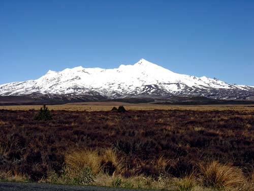
Mt Ruapehu has erupted many times over the last million years. A large crater lake near the summit is an ever-present hazard because renewed volcanic activity may cause lahars (volcanic mud flows) – the most recent occurred in March 2007. The wide plain around the volcano was built up from past lahars that have smothered everything in their path. Lahar deposits are layered with volcanic ash from the eruptions of Mts Ruapehu and Ngāuruhoe.
Using this item
Te Ara - The Encyclopedia of New Zealand
by Shirley Williams
This item has been provided for private study purposes (such as school projects, family and local history research) and any published reproduction (print or electronic) may infringe copyright law. It is the responsibility of the user of any material to obtain clearance from the copyright holder.