Image
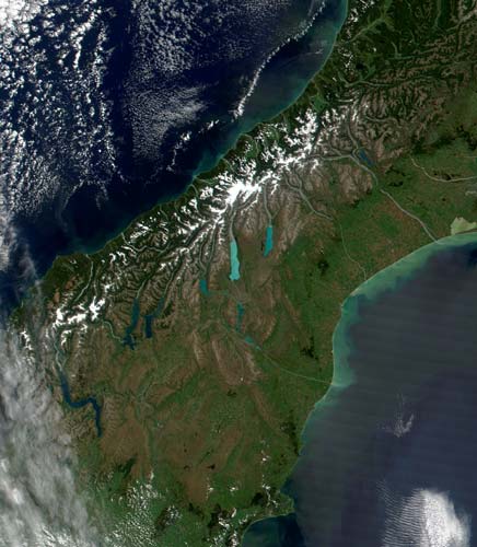
The milky turquoise blue of South Canterbury’s inland lakes stands out in this NASA image of the central South Island. Also visible are the snow-capped peaks of the Southern Alps, the Mackenzie Basin in which the lakes lie, and the coastal downlands.
Using this item
Reference: MODIS Rapid Response Team, NASA/GSFC
by Jacques Descloitres
This item has been provided for private study purposes (such as school projects, family and local history research) and any published reproduction (print or electronic) may infringe copyright law. It is the responsibility of the user of any material to obtain clearance from the copyright holder.