Pastoral runs to freehold estates
South Canterbury’s European farming history began with the runholders who turned sheep onto natural grasslands. The runs were originally leased, but many pastoralists sought to own them. Michael Studholme at Te Waimate, John Acland at Mt Peel, Edward Elworthy at Holme Station and Allan McLean at Waikākahi were among those who acquired very large freehold estates.
After George Rhodes died in 1864, the Levels station was acquired by what became the New Zealand and Australian Land Company. This company remained a major South Canterbury landowner for more than a century. Besides the Levels, it held most of the Hakataramea Valley and the Pareora station.
Saintly Andrew
The South Canterbury township of St Andrews was named not after its Scottish counterpart, but after Andrew Turnbull, a local manager for the New Zealand and Australian Land Company. He had a reputation for using colourful language, so was ironically nicknamed ‘Saint’. The remains of a large granary built by the company in 1878 are the town’s most notable historic feature.
Wheat boom and decline
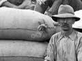
The region’s favourable climate, easily worked soils, and good transport links encouraged cropping. Large-scale wheat growing began in the 1870s and peaked in the early 1900s. Much of the wheat was grown by contractors who leased land from the estate owners.
Flour milling became an important industry in Timaru and Waimate, and wheat and flour were exported through Timaru’s port. The peak export years were 1911 for wheat and 1913 for flour. Wheat growing declined during the First World War, and by 1924 wheat was being imported to keep the mills operating.
Subdividing the large estates
In the late 19th and early 20th centuries, South Canterbury’s large estates were broken up. Some owners sold them off, and others divided them among their families, as it became clear that smaller farms were viable.
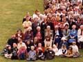
The government played a significant role in making South Canterbury a region of family farms. Village settlements had been established before the 1890s. After the Liberals came to power, South Canterbury (along with North Otago) became the main focus of their ‘lands for settlement’ policies.
Government subdivisions in South Canterbury in the Liberal era included Pareora, Albury, Ashwick, Chamberlain (the Opawa Estate), Rosewill (the remainder of the Levels) and Sherwood Downs. The largest South Canterbury subdivision was Waikākahi: nearly 20,000 hectares was divided into some 140 small farms.