Story: European discovery of New Zealand

Detail of Port Macquarie chart (2nd of 2)

Detail of Port Macquarie chart

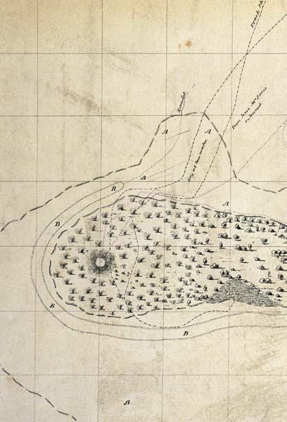
This closer view of Robert Williams's chart shows patches of flax at the entrance to Port Macquarie, now called Bluff.

Using this item

Alexander Turnbull Library
Reference: MapColl-835at/[1813]/Acc425

Permission of the Alexander Turnbull Library, National Library of New Zealand, Te Puna Mātauranga o Aotearoa, must be obtained before any re-use of this image.

All images & media in this story

How to cite this page:

John Wilson, 'European discovery of New Zealand - Last discoveries', Te Ara - the Encyclopedia of New Zealand, http://www.TeAra.govt.nz/en/map/4441/detail-of-port-macquarie-chart (accessed 29 March 2024)

Story by John Wilson, published 8 Feb 2005, updated 1 May 2016