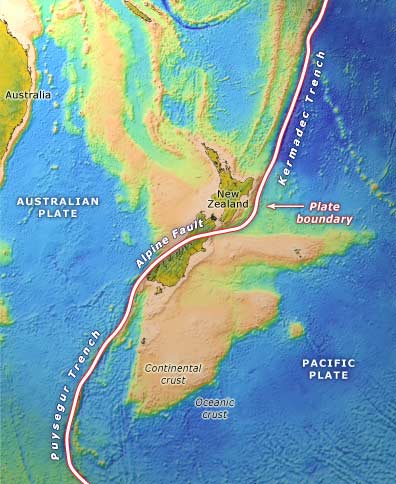
The boundary (pink line) between the Australian and Pacific plates is marked by the Kermadec Trench and the Alpine Fault. All of the North Island, the northern South Island, and a thin strip along the west coast of the South Island are on the Australian Plate, west of the boundary. The rest of the South Island, to the east of the boundary, is on the Pacific Plate. The yellow and pale brown areas are continental crust.
Using this item
Te Ara - The Encyclopedia of New Zealand
Source: GNS Science
This item has been provided for private study purposes (such as school projects, family and local history research) and any published reproduction (print or electronic) may infringe copyright law. It is the responsibility of the user of any material to obtain clearance from the copyright holder.
Comments
07 October 2015