-
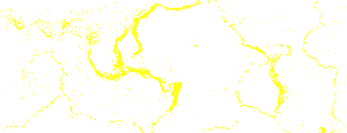
Plate boundaries

-
Earthquakes
-
Volcanoes
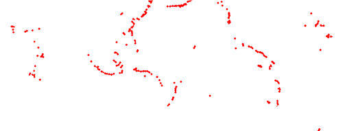
This map shows the location of worldwide large earthquakes between 1980 and 1990. Earthquakes occur on plate boundaries, including the boundary between the Pacific and Australian plates, which runs through New Zealand. Also shown are active volcanoes.
Using this item
Te Ara - The Encyclopedia of New Zealand
This item has been provided for private study purposes (such as school projects, family and local history research) and any published reproduction (print or electronic) may infringe copyright law. It is the responsibility of the user of any material to obtain clearance from the copyright holder.