Image
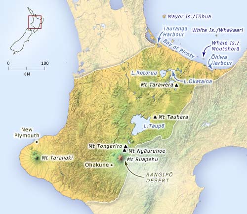
The central part of the North Island shows evidence of young volcanic activity. There are striking volcanic mountains such as Taranaki, Ruapehu and Tarawera, lakes formed by volcanic activity, such as Taupō and Rotorua, and a thick mantle of volcanic ash over the whole region. This map shows the location of places mentioned in the text.
Using this item
Te Ara - The Encyclopedia of New Zealand
This item has been provided for private study purposes (such as school projects, family and local history research) and any published reproduction (print or electronic) may infringe copyright law. It is the responsibility of the user of any material to obtain clearance from the copyright holder.