Image
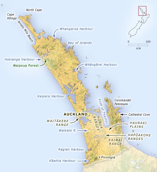
The northernmost part of New Zealand is a north-west-trending peninsula. The rise in sea level after the last ice age led to the flooding of valleys, creating complex, indented harbours and many islands close to the coast. This map shows the location of places mentioned in the text.
Using this item
Te Ara - The Encyclopedia of New Zealand
This item has been provided for private study purposes (such as school projects, family and local history research) and any published reproduction (print or electronic) may infringe copyright law. It is the responsibility of the user of any material to obtain clearance from the copyright holder.