Image
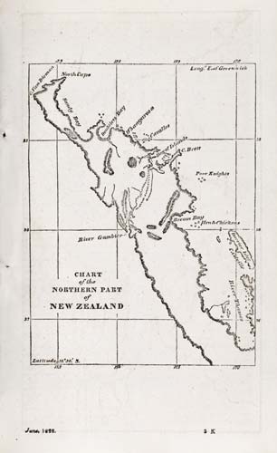
This map was published in 1822 in the Church Missionary Register to illustrate the missionary Samuel Marsden’s journeys. Marsden visited New Zealand a number of times from 1814, and travelled extensively throughout Northland. The routes of the missionaries’ trips inland, and Marsden’s 1819 trip to the Hokianga (River Gambier) are marked. William Puckey, who had previously commanded a ship out of England, accompanied him to the Hokianga. Marsden recorded in his letters that Puckey took soundings and bearings at the mouth of the Hokianga.
Using this item
Reference: B-K 729-249
Permission of the Alexander Turnbull Library, National Library of New Zealand, Te Puna Mātauranga o Aotearoa, must be obtained before any re-use of this image.