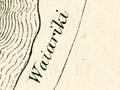
As in Canterbury, the first Pākehā explorers in Otago and Southland were sealers who kept to the coast, and whalers who took up farming and went inland. Sub-protector of aborigines (Māori) Edward Shortland obtained detailed descriptions and drawings of the inland lakes from Te Huruhuru, chief of a settlement on the lower Waitaki River.
In 1844 a New Zealand Company surveyor, Frederick Tuckett, came south in search of new land for settlement. He crossed the Taieri and Tokomairiro plains, which convinced him that Otago was suitable. Within months, the company had purchased the Otago block. Two years later, Charles Kettle arrived to survey the new land. In 1847 he became the first white man to see Central Otago. He made two forays west in 1851 to begin exploring the area.
Further south, land commissioner Walter Mantell made several journeys along the coast. In 1851 he went inland to the Māori village of Tuturau (between present-day Mataura and Wyndham).
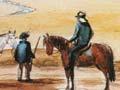
Sheep men
A settlement was established at Dunedin in 1848, and the newcomers mostly stayed close to the coasts. However, as sheep farming became a possibility, they began to hunt for new pasture lands. In 1852 C. J. Nairn followed a Māori guide from the Southland coast as far inland as Lake Te Anau.
Nathanael Chalmers
A Clutha farmer, Nathanael Chalmers, persuaded the Tūtūrau chief Reko to guide him inland in return for a three-legged iron pot. In September 1853, with a second Māori whom they called Kaikōura, they set out up the Mataura River, further up the Nokomai, and over the hills to the Kawarau River. They crossed the river over a ‘rock bridge’ – actually a stretch narrow enough to jump over. On the way they dined on ducks and eels, and Chalmers saw Lake Wakatipu. Going downstream to the Cromwell flats, they followed the upper Clutha River, and Chalmers became the first white man to see Lakes Wānaka and Hāwea. But when Reko offered to take him further north to the Waitaki River, Chalmers, wracked by chronic diarrhoea, declined. The quickest way back was by water. Building a raft of flax stems, the three men sped all the way back through the Cromwell Gorge and almost to the sea.
A heart-stopping ride
In 1910, 57 years after the event, Nathanael Chalmers remembered his raft trip through the Cromwell Gorge: ‘I shall never forget the “race” through the gorge … my heart was literally in my mouth, but those two old men seemed to care nothing for the current.’ 1
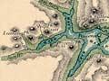
J. T. Thomson
Other sheep men explored Central Otago and the lake district from 1854 to 1856, and the provincial government realised that the region had a future. The price of land, kept high to ensure settlers remained close to Dunedin, was lowered. In 1856 the province appointed a chief surveyor, John Turnbull Thomson, to explore the area. First he went south, surveying Invercargill and reporting on Southland. This quickly triggered a rush of aspiring farmers. He also visited chief Reko and learned about the interior. In 1857 he investigated the Maniototo, then went up the Waitaki River, saw Lakes Hāwea and Wānaka, and named Mt Aspiring. Finally, he visited Lakes Ōhau and Pūkaki. Thomson had described 5,000 square miles (13,000 square kilometres) of land, and within 18 months of his newspaper reports, sheep farmers had taken up the land.
Filling in the gaps
Some farmers explored uncharted territory as they searched for new pastures east of the Alps. In 1861–63 the surveyor James McKerrow systematically recorded the area from Manapōuri and Te Anau in the south to Wānaka and Hāwea in the north.