Image
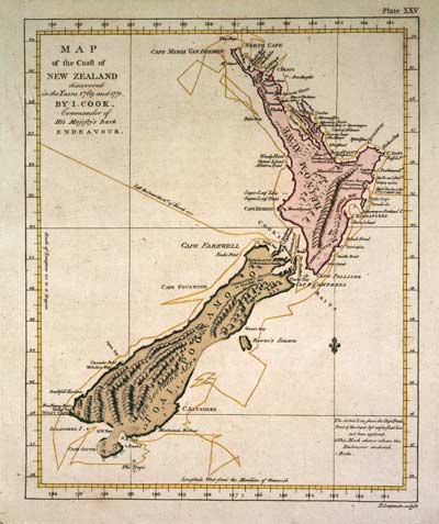
Abel Tasman had charted only the western coastline of New Zealand, from about Punakaiki to the North Cape, and left open the possibility that the land was part of a great, unknown southern continent. The English explorer James Cook established that the land Tasman had discovered was in fact two large islands. The remarkably accurate map Cook drew of New Zealand after his first circumnavigation of the islands in 1769–70 was a marvel of cartography.
Using this item
Reference: PUBL-0037-25
Permission of the Alexander Turnbull Library, National Library of New Zealand, Te Puna Mātauranga o Aotearoa, must be obtained before any re-use of this image.