
Preparing to sail
The most manageable long-distance canoes were about 20 metres long, with a crew of between five and 15. Food carried on board might include bananas, taro, kūmara (sweet potato), chickens, pigs, fish, breadfruit, yams and gourds. Coconuts served as both food and drink. Water was stored in gourds, and voyagers also caught rainwater in the sails. West Polynesian traditions speak of thirsty voyagers draining the blood of large fish into coconut shells. This may have been especially tasty.
Voyage routes were preserved in memory or recorded in song. They were mapped using notable landscape features such as mountains, outcrops of rock and prominent trees, lined up with known star paths. The term for this method of navigation is back-sighting. Navigators would set sail at dusk, lining up their canoe with prominent landmarks behind them, and follow the relevant star path as the sun set.
Navigation at sea
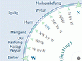
The principles of traditional Polynesian navigation were simple, but its practice was refined over generations of experience. The greatest skill of the old navigators was their ability to read the night sky. The rising and setting points of the brightest and most distinctive stars and planets were gauged with the help of sophisticated star compasses, and then memorised. Compasses were also used to chart the winds.
Navigators steered their canoes toward a star on the horizon. When that star rose too high in the sky or set beneath the horizon, another would be chosen, and so on through the night. Seven to 12 stars were sufficient for one night's navigation, and the moon and bright planets such as Kōpō (Venus) and Pareārau (Jupiter) were also useful. At daybreak, navigators noted the position of the canoe in relation to the rising sun. As the sun got higher in the sky, they looked to where it would set in the evening.
When skies were too overcast for navigators to use the sun, the moon, planets or stars, their course could be gauged according to ocean swells. In the Pacific, prevailing north- and south-easterly trade winds pushed up swells that remained constant for long periods. Navigators kept their canoes at the same angle to these swells. Sudden changes in canoe motion indicated that it had changed course. To avoid veering off course, a rope was trailed behind the canoe – if a wave suddenly jarred the vessel, the rope remained true to the original line of travel. Some navigators also lined up their canoe with wind direction, using pennants tied to the mast and rigging as guides.