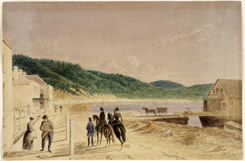
This watercolour is of Wellington Beach, just north of Windy Point (now the corner of Lambton Quay and Willis Street) in 1856. The quay connected the northern (Thorndon) and southern (Te Aro) parts of the settlement, and was lined with shops, hotels and other small businesses. The warehouse at right is a converted barque, the Inconstant. The vessel foundered at the harbour’s entrance in 1849 and was later salvaged by local merchant John Plimmer. Nicknamed Plimmer’s Ark, it quickly became the centre of Wellington trade. Opposite the Ark is Barrett’s Hotel, also owned by Plimmer and named after the early whaler Dicky Barrett.
Using this item
Reference: A-032-040
by William Howard Holmes
Permission of the Alexander Turnbull Library, National Library of New Zealand, Te Puna Mātauranga o Aotearoa, must be obtained before any re-use of this image.