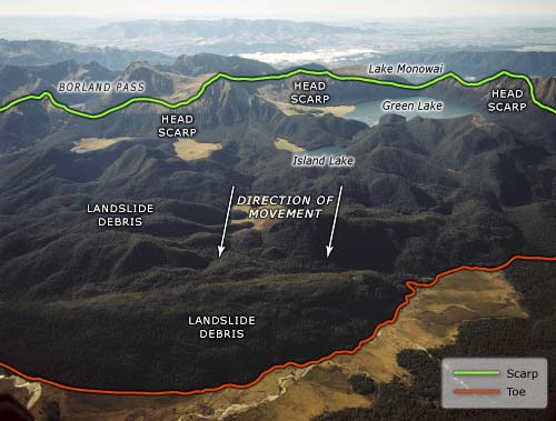
This is the terrain surrounding New Zealand’s largest documented terrestrial landslide, which occurred 12,000–13,000 years ago. The area in the centre of the photograph is the landslide. The mountains labelled ‘head scarp’ are where the landslide slipped (marked by the green line) The toe of the landslide is indicated by the red line. The undulating terrain and lakes are typical features of a landslide’s surface – but on a much larger scale than usual. The slide is thought to have occurred when glaciers propping up a mountainside melted. With its support gone, a 9-kilometre section of the mountain collapsed onto the valley floor 700 metres below.
Using this item
Reference: CN10231/25
by Lloyd Homer
Permission of GNS Science must be obtained before any use of this image.