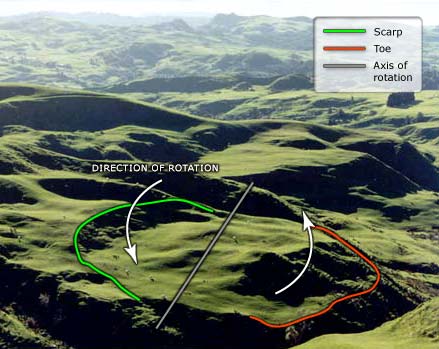
A rotational landslide is visible in this King Country pasture. The green curve at centre left is the scarp (the area where the ground has failed). The sheep below it are on top of the landslide. The hummocky ground at bottom right (in shadow) is the toe of the landslide (red line). It is called a rotational landslide as the earth has moved from left to right on a curved sliding surface. The direction and axis of rotation are also depicted.
Using this item
Private collection
Photograph by Mike Crozier
This item has been provided for private study purposes (such as school projects, family and local history research) and any published reproduction (print or electronic) may infringe copyright law. It is the responsibility of the user of any material to obtain clearance from the copyright holder.


Add new comment