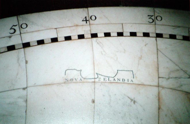
It seems likely, but not certain, that within a decade of Tasman’s discoveries, this outline of Nova Zelandia was etched in marble on the floor of Amsterdam’s Great Civic Hall in their new Stadhuis or town hall, built in 1648. The marble floor which can be seen today in the now Royal Palace in Amsterdam replaced the worn original in the 1750s. Since other of Tasman’s discoveries were definitely represented in the original floor, it is probable that Nova Zelandia was also part of the world map. There were two planispheres on the floor, one for the eastern hemisphere and one for the western. Their diameter was over six metres.
Using this item
Private collection
by Dirk R. Rinckes
This item has been provided for private study purposes (such as school projects, family and local history research) and any published reproduction (print or electronic) may infringe copyright law. It is the responsibility of the user of any material to obtain clearance from the copyright holder.