Image
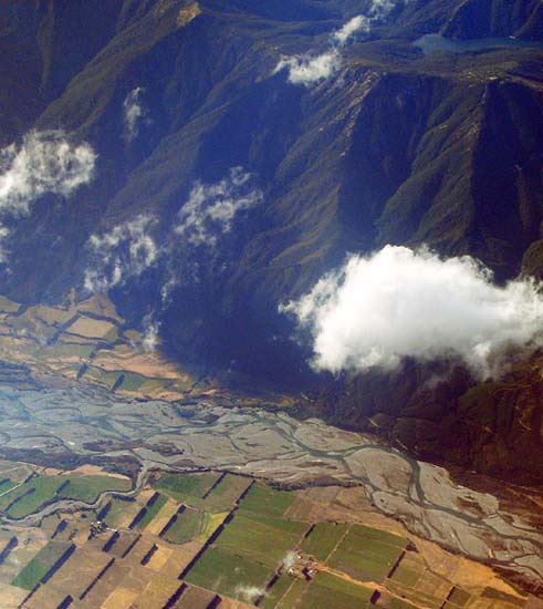
The line of the Wairau Fault shows up dramatically in this aerial view, with the braided Wairau River in the foreground and the Richmond Range rising sharply from the river's north bank. Lake Chalice, the product of a landslide, nestles in the range and is visible at the top of the picture.
Using this item
by Michael Rymer
This item has been provided for private study purposes (such as school projects, family and local history research) and any published reproduction (print or electronic) may infringe copyright law. It is the responsibility of the user of any material to obtain clearance from the copyright holder.