Image
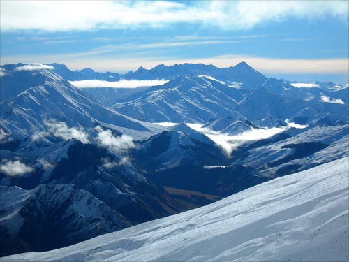
At 3,027 metres, Mt Aspiring/Tititea – the triangular summit in the distance at right – is Otago’s highest peak. It is part of the highest section of the Southern Alps outside the Aoraki/Mt Cook region. This photograph was taken from the slopes of Ben Lomond, above Queenstown, 60 kilometres from Mt Aspiring.
Using this item
Te Ara - The Encyclopedia of New Zealand
by Jock Phillips
This item has been provided for private study purposes (such as school projects, family and local history research) and any published reproduction (print or electronic) may infringe copyright law. It is the responsibility of the user of any material to obtain clearance from the copyright holder.