Image
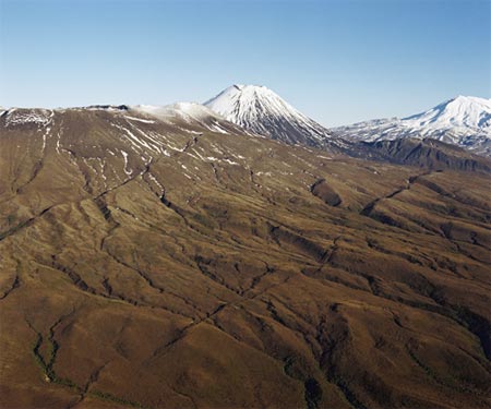
Mt Tongariro (the flat-topped mountain in the left foreground of this photograph) marks the southern boundary of the Te Arawa peoples. In Te Arawa tradition the explorer Ngātororoirangi climbed Tongariro as a storm was raging. When he finally reached the summit, Ngātororoirangi cried out for his sisters Kuiwai and Haungaroa in Hawaiki to send him some fire. With this fire he created a volcano and named it after his sacrificed slave, Ngāuruhoe. In this view Mt Ngāuruhoe can be seen in the middle ground, and Mt Ruapehu on the right.
Using this item
Reference: 5322/11
by Lloyd Homer
Permission of GNS Science must be obtained before any use of this image.