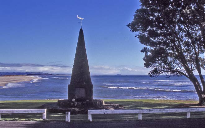
This monument at Ōngātoro, Maketū, was built for New Zealand’s 1940 centennial celebrations of the signing of the Treaty of Waitangi. It marks the landing point of the Te Arawa canoe after its journey of over 3,000 km from Hawaiki. The Kaituna River flows into the sea behind the monument and the land on the horizon in the middle of the picture, which appears to be an island, is Mt Maunganui.
Using this item
Te Ara - The Encyclopedia of New Zealand
by Peter Hodsell
This item has been provided for private study purposes (such as school projects, family and local history research) and any published reproduction (print or electronic) may infringe copyright law. It is the responsibility of the user of any material to obtain clearance from the copyright holder.