Image
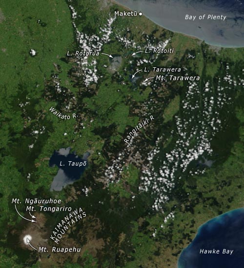
The extent of the Volcanic Plateau is shown in this aerial image, from the Bay of Plenty coast at top right to Mt Ruapehu (with snow-capped summit) at bottom. The ‘line of fire’ extends from Ruapehu, across Taupō and on to the coast.
Using this item
This item has been provided for private study purposes (such as school projects, family and local history research) and any published reproduction (print or electronic) may infringe copyright law. It is the responsibility of the user of any material to obtain clearance from the copyright holder.