Image
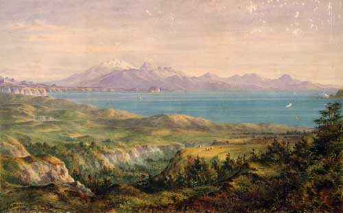
Charles Barraud painted this watercolour, ‘Looking across Lake Taupo with Mounts Tongariro, Ngauruhoe and Ruapehu in the distance’, in 1874. By that time adventurous travellers were finding their way into the central North Island. Motutaiko Island is in the middle distance, below the rounded shape of Pīhanga.
Using this item
Reference: C-007-005
by Charles Decimus Barraud
Permission of the Alexander Turnbull Library, National Library of New Zealand, Te Puna Mātauranga o Aotearoa, must be obtained before any re-use of this image.