Image
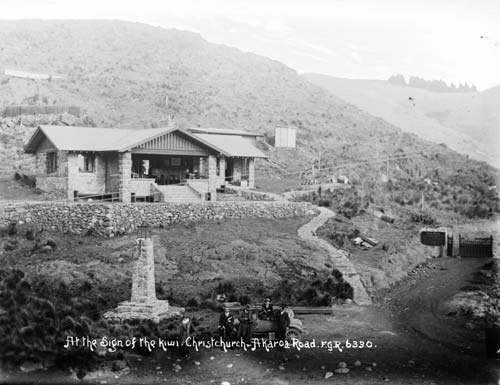
Conservationist Harry Ell had a vision of a network of scenic reserves around the Port Hills, near Christchurch, to be connected by a road with regularly spaced resthouses.
This shelter, the Sign of the Kiwi, is at the junction of the Summit Road and the road to Governors Bay. Designed by Samuel Hurst Seagar in the arts-and-crafts style, it was built between 1914 and 1917.
Using this item
Alexander Turnbull Library, F. G. Radcliffe Collection (PAColl-4950)
Reference: 1/2-006514; G
by Frederick George Radcliffe
Permission of the Alexander Turnbull Library, National Library of New Zealand, Te Puna Mātauranga o Aotearoa, must be obtained before any re-use of this image.