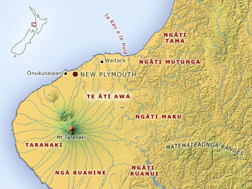
This map shows the traditional lands of Te Āti Awa of Taranaki. On the coast, the southern boundary is Ōnukutaipari, near New Plymouth, and the northern boundary is Te Rau o te Huia, near Motunui. The inland boundaries, some of which are disputed by neighbouring tribes, stretch from the north-eastern slopes of Mt Taranaki inland to the Matemateaonga Ranges.
Using this item
Te Ara - The Encyclopedia of New Zealand
This item has been provided for private study purposes (such as school projects, family and local history research) and any published reproduction (print or electronic) may infringe copyright law. It is the responsibility of the user of any material to obtain clearance from the copyright holder.