Image
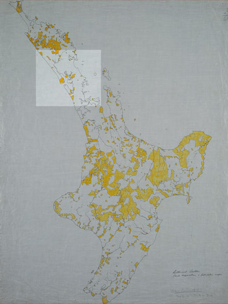
This yellow areas on this map are the land still in Māori ownership in 1910. The traditional lands of Ngāti Whātua are again highlighted. By this date the pockets of land owned by Ngāti Whātua were few and scattered.
Using this item
Alexander Turnbull Library, Centennial Historical Atlas Collection
Reference: MapColl-CHA-6/2/6-Acc.38315
Permission of the Alexander Turnbull Library, National Library of New Zealand, Te Puna Mātauranga o Aotearoa, must be obtained before any re-use of this image.