Image
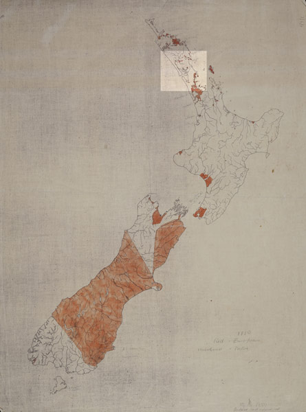
The red areas on this map are the land held by Europeans in 1850. The traditional area of Ngāti Whātua is highlighted. At this time only the area around Auckland had been lost; but much was sold over the next 15 years and in 1865 58% of the land in the Kaipara district was no longer in Māori ownership.
Using this item
Alexander Turnbull Library, Centennial Historical Atlas Collection
Reference: MapColl-6/2/5
Permission of the Alexander Turnbull Library, National Library of New Zealand, Te Puna Mātauranga o Aotearoa, must be obtained before any re-use of this image.