Image
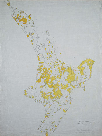
By 1910 sales and confiscation of land had reduced the area of Māori-owned land in the North Island dramatically. This map indicates in yellow those areas remaining in Māori ownership. Reduced land holdings made farming less economic for some tribes, and forced many Māori to find work in towns and cities.
Using this item
Alexander Turnbull Library, Centennial Historical Atlas Collection
Reference: MapColl-CHA-6/2/6-Acc.38315
Permission of the Alexander Turnbull Library, National Library of New Zealand, Te Puna Mātauranga o Aotearoa, must be obtained before any re-use of this image.