Image
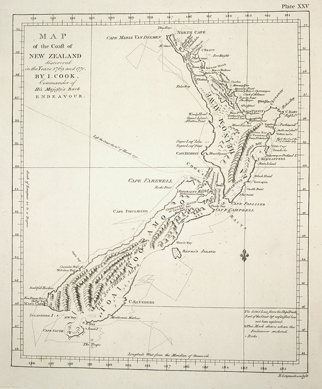
This map was charted by James Cook on his first voyage to New Zealand, in 1769–70. It records the Māori names for the North and South islands. ‘Ea hei nom auwe’ is either a version of He ahi nō Māui (fire from Māui) or He mea hī nō Māui (fished up by Māui). The South Island is ‘Toai Poonamo o’, which is probably a corruption of Te Wai Pounamu (the greenstone waters).
Using this item
Reference: PUBL-0037-25
Permission of the Alexander Turnbull Library, National Library of New Zealand, Te Puna Mātauranga o Aotearoa, must be obtained before any re-use of this image.