Image
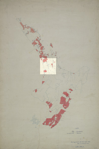
This map, prepared for the unpublished New Zealand centennial historical atlas in the 1940s, shows in red the land purchased by Europeans by 1860. It reveals how at this stage very little land in the Waikato area was in European ownership. This situation was soon to change dramatically. Following the Waikato war of 1863–64, vast areas of land were taken by the government in retribution.
Using this item
Alexander Turnbull Library, Centennial Historical Atlas Collection
Reference: MapColl-CHA-6/2/3-Acc.38312
Permission of the Alexander Turnbull Library, National Library of New Zealand, Te Puna Mātauranga o Aotearoa, must be obtained before any re-use of this image.