Image
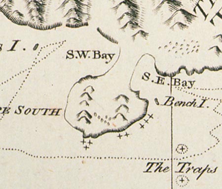
In the second of two main mistakes on Cook’s map of New Zealand, Stewart Island is recorded as a possible peninsula. In fact, Cook thought there probably was a passage between what he mapped as South-west Bay and South-east Bay, and left his chart incomplete. Foveaux Strait was first discovered when an American sealing ship sailed through it in 1804.
Using this item
Reference: PUBL-0037-25
Permission of the Alexander Turnbull Library, National Library of New Zealand, Te Puna Mātauranga o Aotearoa, must be obtained before any re-use of this image.