Image
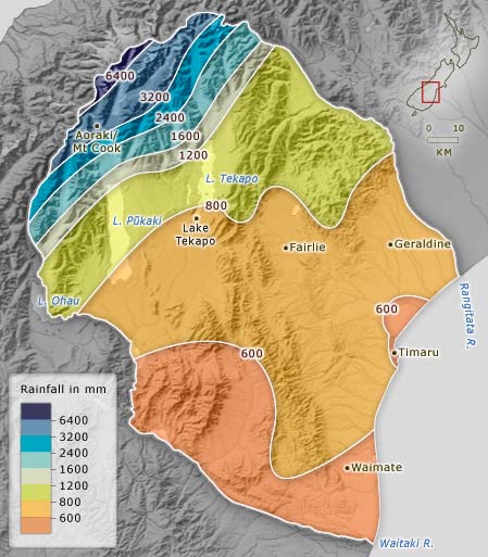
South Canterbury is a region of rainfall extremes. On reaching the barrier of the Southern Alps, moist westerly winds rise and cool, causing heavy rain. As the airmass crosses the region, it runs out of moisture and the amount of rainfall decreases.
Using this item
Te Ara - The Encyclopedia of New Zealand
This item has been provided for private study purposes (such as school projects, family and local history research) and any published reproduction (print or electronic) may infringe copyright law. It is the responsibility of the user of any material to obtain clearance from the copyright holder.