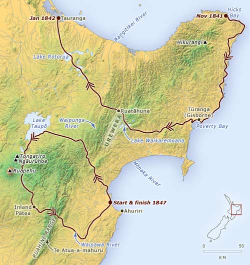
This map shows two of William Colenso’s major journeys on the East Coast of the North Island. In December 1841 and January 1842 he set off from Hicks Bay and found a route through the Urewera region to Tauranga. He then went further north to the Bay of Islands, where he was based. In 1847, after being transferred to Ahuriri (Napier) to establish a mission, Colenso succeeded in his second attempt to reach a Māori settlement at inland Pātea, in the upper Rangitīkei district.
Using this item
Te Ara - The Encyclopedia of New Zealand
This item has been provided for private study purposes (such as school projects, family and local history research) and any published reproduction (print or electronic) may infringe copyright law. It is the responsibility of the user of any material to obtain clearance from the copyright holder.
Comments
17 March 2013