-
1867-1919
-
1919-1951

-
1951-1954
-
1954-1984
-
1984-1987
-
1987-1995

-
1995-1998
-
1998-2002
-
2002-2004
-
2004-2007
-
2007-present
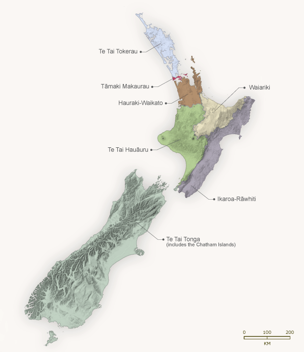
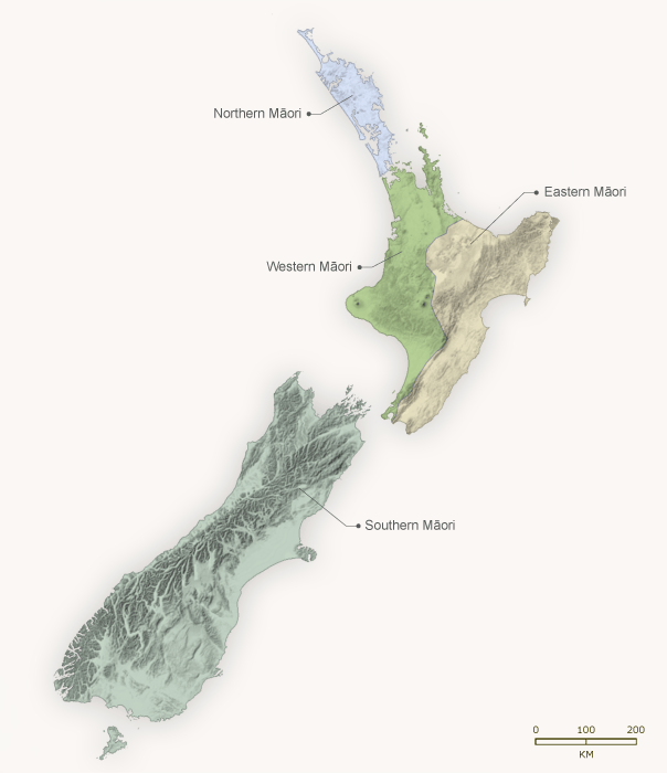
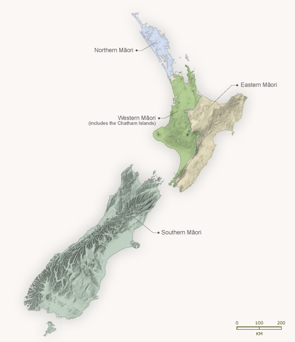
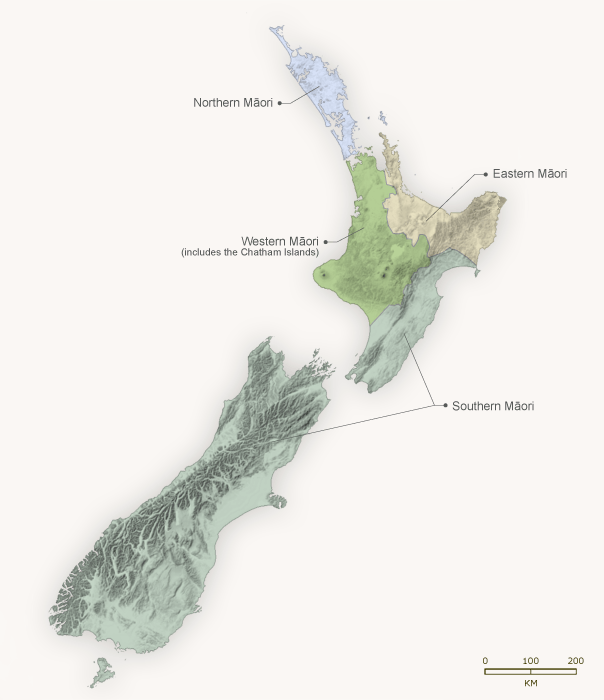
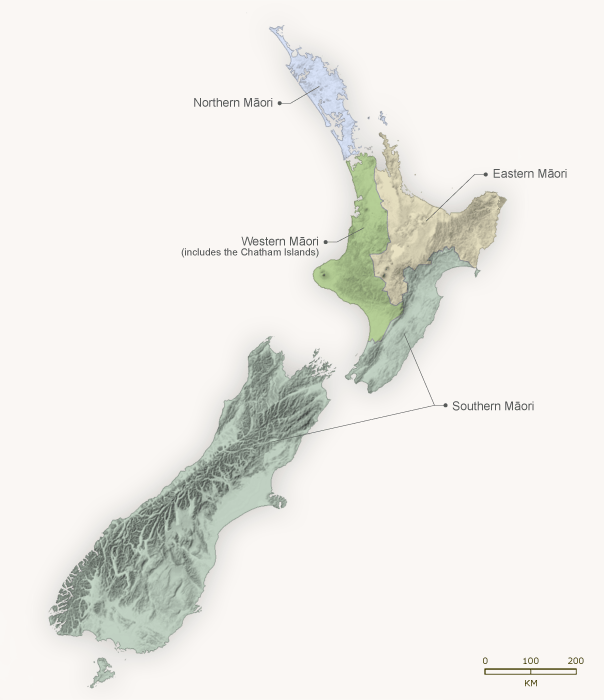
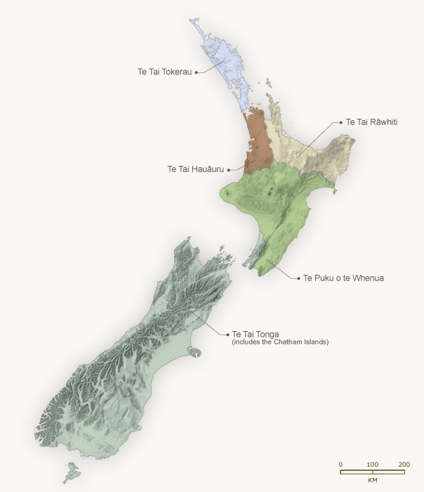
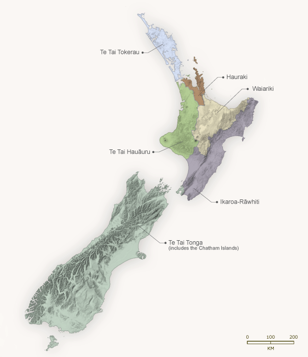
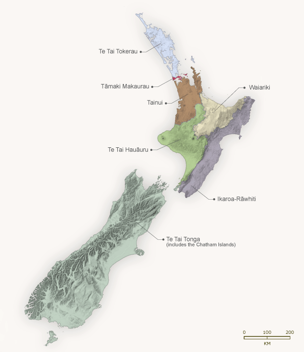
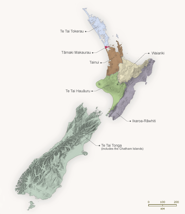
Click on this series of maps to see how the Māori electorates have changed, in number and shape, over time. (Note that the maps show only the major changes.) In 1867, when most Māori men were given the vote, four separate Māori seats were created. By 2004 the number had grown to seven.
Using this item
Te Ara - The Encyclopedia of New Zealand
Source: Elections New Zealand.
This item has been provided for private study purposes (such as school projects, family and local history research) and any published reproduction (print or electronic) may infringe copyright law. It is the responsibility of the user of any material to obtain clearance from the copyright holder.