


Story summary
Māori and maps
Māori were living in New Zealand by around 1300 CE. They named the mountains, rivers and harbours, but map-drawing was not part of their tradition. Later, they helped Europeans explore, and some sketched maps to provide information about the land.
Abel Tasman: 1642
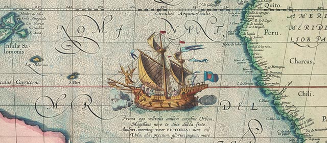
People once thought that there must be a huge land mass in the southern hemisphere to balance the large continents of the northern hemisphere. The Dutch seafarer Abel Tasman was one of many sent out to find it. Instead, he reached the islands of New Zealand. He drew two charts, and in 1646 New Zealand was shown on a world map for the first time.
James Cook: 1769
Nearly 130 years after Tasman, the English navigator James Cook set off in the Endeavour to look for the mythical southern land. He too reached New Zealand and sailed around it, making the first complete outline of its coasts. This proved that the country was not part of a larger land mass. Cook’s charts had only two major mistakes: he thought that Banks Peninsula was an island, and that Stewart Island was joined to the South Island.
French explorers to 1840
Several Frenchmen made maps, including:
- J. F. M. de Surville: arriving at the same time as Cook, he charted the northern coastline
- Marion du Fresne: on one map he showed Mt Taranaki
- J. S. C. Dumont d’Urville: he made 14 charts, and showed Banks Peninsula in almost correct form.
Traders, whalers, missionaries: 1800–1840
Europeans came to trade in flax, seals, whales and timber. Their maps showed the harbours they visited, and where the resources were. Missionaries came to convert Māori to Christianity. They also explored and mapped parts of the land.
Settlers: 1840s onwards
When British immigrants began arriving, there were almost no maps of inland New Zealand. Surveyors looked for good sites for settlement, mapping the rough, mountainous country. Planners drew maps of new towns, showing parks and wide streets. Sometimes they did this without seeing the land, which might actually have swamps, hills and thick forest.
Later maps
Gold was discovered in the 1850s and 1860s. Scientists explored inland, drawing charts of mountains and other places where there might be gold and other valuable resources.
By 1855, the British survey ships Acheron and Pandora had made accurate maps of the entire coastline.