
Story: Landslides

Earth shake

Image
Earth shake

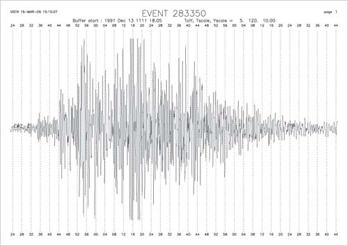
A seismograph at Erewhon, about 60 kilometres from Aoraki/Mt Cook, recorded the 1991 landslide. The earth vibrated with the massive weight of rock that rumbled down the mountain. Seismographs as far away as Wellington (500 kilometres distant) registered the impact.

Using this item

GNS Science

Permission of GNS Science must be obtained before any use of this image.

All images & media in this story

How to cite this page

Michael J. Crozier, Landslides – Alpine, low mountain and layered rock landslides, Te Ara – the Encyclopedia of New Zealand, https://teara.govt.nz/en/document/8786/earth-shake (accessed 18 June 2026).

Story by Michael J. Crozier, published 2 March 2009, updated 19 February 2026.