Image
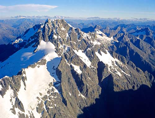
Mt Tūtoko (2,746 metres) is the highest mountain in Fiordland. Although almost 1,000 metres lower than Aoraki/Mt Cook, the highest peak of the Southern Alps, it rises higher than any North Island mountain except Ruapehu (2,797 metres). It is part of the Darran Mountains, which separate Milford Sound from the Hollyford Valley.
Using this item
Reference: 11335AM@3
by Rob Suisted
This item has been provided for private study purposes (such as school projects, family and local history research) and any published reproduction (print or electronic) may infringe copyright law. It is the responsibility of the user of any material to obtain clearance from the copyright holder.