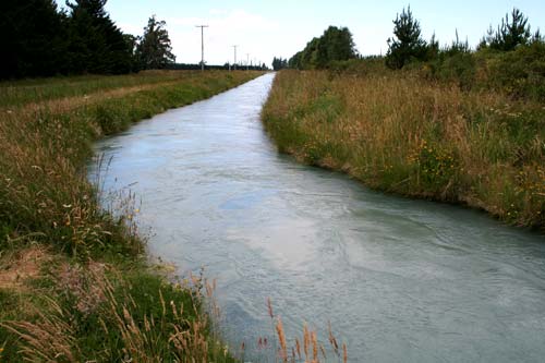
Irrigation of the Canterbury Plains was essential to the success of mixed farming. Large-scale irrigation began in 1945 with a diversion race from the Rangitātā River to the Rakaia. By 2002 there were 188,170 hectares of irrigated land in the region. Ten years later the area under irrigation had more than doubled, to 385,271 hectares. This channel is at Mayfield, north-west of Ashburton.
Using this item
Te Ara – The Encyclopedia of New Zealand
by Jock Phillips
This item has been provided for private study purposes (such as school projects, family and local history research) and any published reproduction (print or electronic) may infringe copyright law. It is the responsibility of the user of any material to obtain clearance from the copyright holder.