
Polynesian and Māori forecasting
When the Polynesian ancestors of Māori voyaged to New Zealand they sought and used knowledge about the weather. They would sail south to catch the westerly winds, and north to catch the south-easterly trade winds. Māori traditionally used the patterns and colours of clouds to predict the weather. They would observe cloud formations at sunset to tell whether and when it would rain the following day.
Getting wind of trouble
During the wars in south Taranaki in 1868, Ngā Ruanui leader Tītokowaru, who had only 80 men to the British army’s 1,000, planned an armed attack on a redoubt only 5 kilometres from the British camp. He chose to attack at a time when he predicted there would be strong westerly winds. His forecast was right, and the sound of gunfire was carried away from the camp by the winds. In the ambush only six of his men were wounded.
European observations
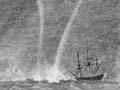
European explorers were also interested in the weather. On his 1642 voyage of discovery, for example, Abel Janszoon Tasman had been instructed by the Dutch East India Company to note the winds he encountered, as well as monsoons, rains and other seasonal variations. James Cook’s second voyage in 1772–75 resulted in the compilation of extensive meteorological logs. Their publication left no doubt in the minds of those who would follow him that New Zealand’s coasts were subject to violent and frequent storms, and at times alarming and rapid changes in weather.
The first European missionaries and settlers who made their way to New Zealand in the early 19th century observed and recorded the temperature, barometric pressure, wind direction and other weather patterns out of curiosity about their new environment. They were quick to make comparisons with the climate in Britain. Favourable accounts were published in Britain to encourage immigration, providing a highly coloured picture of a warm and hospitable country.
A national weather service
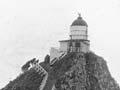
Following earlier moves by the military and various harbour boards to collect and regularly report weather conditions, official arrangements for a weather service in New Zealand were made in 1861. The government established a network of nine reporting stations extending from the Bay of Islands to Dunedin. After a hesitant start, services proved to be far from adequate. This, together with concern over the number of ships wrecked during storms along the coast in the mid-1870s, eventually led to action by the Marine Department.
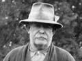
Having earlier established an experimental storm warning scheme, in January 1874 the Marine Department appointed Commander Robert Edwin as New Zealand’s first official weather forecaster. Within two years the weather reporting section was functioning along lines developed by Robert FitzRoy (a former governor of New Zealand and commander of the Beagle) in his influential Weather book (1863), published in England.
Printed forecasts
Newspapers began printing weather maps at the end of 1882. These were based on the reports of about 24 observation stations. Robert Edwin sent daily reports to the major papers, along with code numbers that corresponded to one of the 24 isobaric (air pressure) patterns commonly occurring over New Zealand. The number indicated which map to print.
Technological developments
After the First World War, advances in radio technology meant that weather reports could be received from ships at sea. Soon after, a group of Norwegian meteorologists researching mid-latitude cyclones introduced the idea of fronts (where two different air masses meet). New Zealand’s meteorological service soon used this research in their forecasts.
When regular air services began in New Zealand in 1935, the number of reporting stations and the frequency of reports greatly increased. Some stations began to take measurements in the upper atmosphere using weather balloons tracked by theodolite. In 1942, radiosondes were also introduced – attached to balloons, these transmitted pressure, temperature and humidity readings.
Service providers
Forecasting remained a marine service until 1926, when it became part of the newly formed Department of Scientific and Industrial Research. Responsibility shifted to the Royal New Zealand Air Force in 1939, and later the Department of Civil Aviation and the Ministry of Transport. Finally, during the 1980s, a combination of commercial competition arising from a deregulated market and a move to publicly funded science led to the establishment of two government bodies responsible for meteorology. MetService, a state-owned enterprise, is responsible for operational meteorology and weather forecasting, while the National Climate Centre at the National Institute of Water and Atmospheric Research is part of a Crown research institute charged with tracking global influences on New Zealand's climate, particularly the El Niño–La Niña weather patterns, and sea-surface temperatures.
New Zealand was one of the first countries to commercialise weather forecasting. While most people continue to rely on the government-run MetService, new companies such as Blue Skies Weather and Climate Services provide customised forecasts for their clients.