Image
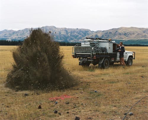
A geologist fires off an explosive device near Hanmer Springs, in Canterbury. The shock waves bounce off underground rock layers and back towards the surface, where they are recorded by sensitive instruments. The data gathered is used to draw maps of the underground structures. This helps geologists pinpoint areas where oil and gas might be trapped.
Using this item
Reference: CN19413/17
by Lloyd Homer
Permission of GNS Science must be obtained before any use of this image.