Image
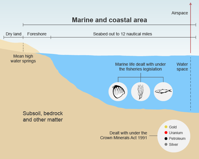
This diagram shows the legal extent of the foreshore and seabed under the Marine and Coastal Area (Takutai Moana) Act 2011. The foreshore is the land between the high and low water marks at mean spring tides, while the seabed is the land covered by sea water out to 12 nautical miles (in other words, New Zealand’s territorial waters). Specific minerals are excluded under the current law, and marine life is covered by other legislation, including the Fisheries acts 1983 and 1996, and the Maori Fisheries Act 2004.
Using this item
Reference: CN46841/24
by Lloyd Homer
Permission of GNS Science must be obtained before any use of this image.