Image
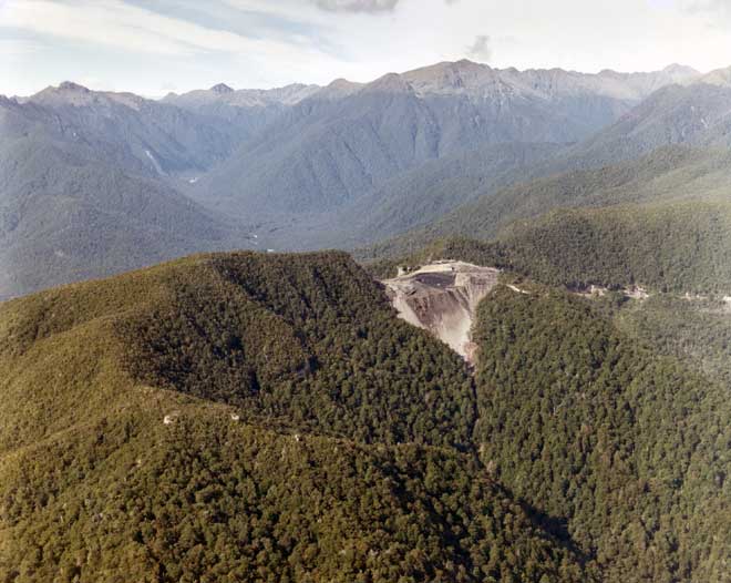
Island Block is an isolated patch of coal measures on the ridge between Garvey Creek and the Waitahu River. It was discovered in 1944 by geologist Harold Wellman, who predicted that bituminous coal might be found there based on his regional studies of coal rank. A thick seam contains over 15 metres of high-quality bituminous coal, and it is mined by opencast methods. This photograph was taken in 1977. The mine has not been worked since 2002.
Using this item
Reference: CN699a
by Lloyd Homer
Permission of GNS Science must be obtained before any use of this image.