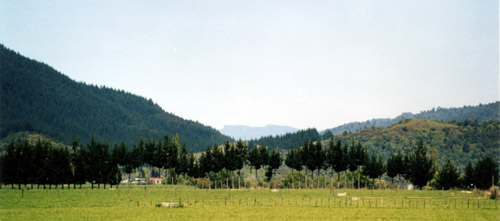
The Waimana Valley is in the northern Urewera. This photograph is taken from near Tātaiahape marae, looking south towards the Matahī Valley. Maungapōhatu is in the distance. The river that runs through the valley is also known as Waimana; however its original name is Tauranga. It joins the Ōhinemataroa River at a point one kilometre south-west of the town of Tāneatua.
Using this item
Private collection
Photograph by Leanne Tamaki
This item has been provided for private study purposes (such as school projects, family and local history research) and any published reproduction (print or electronic) may infringe copyright law. It is the responsibility of the user of any material to obtain clearance from the copyright holder.


Comments
ohh meann fottoz and info
maryy (not verified)
02 April 2011
Add new comment