Image
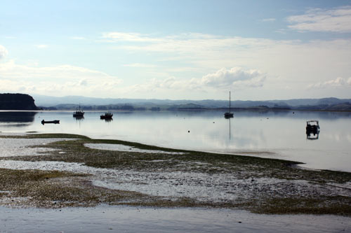
Kāwhia Harbour is a large estuary which was formed when a valley was inundated with water and blocked by the formation of a sandbar at the coast. The harbour provided food for generations of Māori communities and remains a popular fishing spot in the 21st century. On a still, sunny day the waters are like a vast mirror. This is the harbour, looking out from Kāwhia township at low tide.
Using this item
Te Ara - The Encyclopedia of New Zealand
by A. D. Wright
This item has been provided for private study purposes (such as school projects, family and local history research) and any published reproduction (print or electronic) may infringe copyright law. It is the responsibility of the user of any material to obtain clearance from the copyright holder.